|
Lewiston, New York
Location: Devil's Hole Cave is located in Devil's Hole State Park, just north of the City of Niagara Falls, NY. The park has two parking areas. One can only be accessed from the southbound lane of the Robert Moses State Parkway. The other parking area can be accessed from the northbound lane of the Robert Moses State Parkway and Route 104.
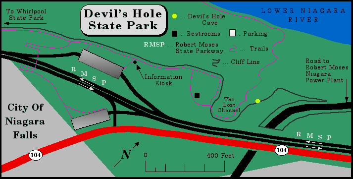
Devil's Hole State Park overlooks the Lower Niagara River. A hiking trail leads from the park down 300 vertical feet to the turbulent Devil's Hole Rapids. The very rugged trail affords spectacular views of the gorge and the rapids. It is a popular spot for fishermen especially for salmon and trout. Park regulations state that you must stay on established trails and do not enter the water. A few picnic tables can be found in the area to the west of the restrooms. Admission to the park is free.
The following description was taken in part from a brochure for the Great Gorge Route Railroad and the Niagara Falls & Suspension Bridge Railroad. The brochure is undated, but local historians tell me it was most likely printed in the late 1890's. Comments by the author are in [italics].
Teeming with Indian legends, replete with wild picturesque scenery, the great Council Rock of the Indians, the Lost Channel of the Bloody Run, the Mineral Spring, and the awful precipice over which 350 British Soldiers were driven, makes the Devil's Hole the most interesting point at Niagara, and is deserving of a more particular examination than has heretofore been within the power of the visitor to make.
This wonderful rock stands at the head of the long stairway. As you approach it, step up to the right hand side of it, so you can see its original shape, its foundation stone having settled allows it to tip towards the river, but when in its original position it was an arrow shaped rock. Around it the Chief of the Indian tribes held their yearly Council. It is regarded by some as being a worshipping stone, closely connected with their religion. Others claim it marks the victory of hard fought battles, and still others say it was the place of the Chiefs, but as Indian history was not written, its exact significance will probably never be known. The peculiar manner in which the Indians stood about the rock while in Council (one hand upon the rock) has caused the story (and to many the fact) that by placing your hand upon it, you will drive the devil away for a year. [The rock is believed to have been located just east of the restrooms. It may of been destroyed or it was removed sometime after the brochure was published.]
Where the old Bloody Run stream used to wind in its circuitous dash to the river, falling over 300 feet in its short journey of less than 1,000 feet. There is not a drop of water running through the channel now, while less than fifty years ago there was water enough to run the old saw mill.
September 14th, 1763, Three hundred and fifty British Soldiers, which composed a supply train, marched on their way from Fort Niagara to Fort Schlosser [located about two miles upriver of Niagara Falls], marched alas only to meet their death. On the large flat rock back of the Devil's Hole buildings [restrooms], beside the little stream, these soldiers halted for dinner. While they were eating they were attacked by the Seneca Indians. The first fire produced great destruction of life. Those who were not thus killed were driven over alive over the awful precipice. After these men jumped the Indians drove the Horses, Wagons and baggage of the entire train over on top of them and only two survived to tell of the plan conceived and carried out by the Indians to massacre them at this particular spot, where a careless guard would be at the mercy of a hidden foe; a plan bold and skillful in formation, masterly in execution, was gained, as so many Indian attacks, by secret and deadly ambuscade.
It [the cave] was originally nearly three-quarters of a mile in length. It contained three very large rooms which stood at right angles from the main hallway and were about 20 feet in width and 12 feet in height. Until 1854 this hole was in a perfect state of preservation. At that period a railroad made a deep cut diagonally over the main hallway. Their heavy blasting caused the rocks to fall and has closed the passage so that visitors should not attempt to go beyond the Mineral Spring. At the period when Europeans first visited this locality, the Devil's Hole was inhabited by the Neuter Nation of Indians and used by them as a hiding place in times of war. To keep their hiding place a secret, these Indians killed every person who entered the gorge at this point, and as these people never returned their friends came to regard this place as the home of the spirit of evil. In this way it naturally took its name, "The Devil's Hole".
Directly in front of the Devil's Hole is a very interesting rock. It is chipped and pointed in the same manner that the Indians pointed their Arrow heads. Its important position prevents anything from being shot into the Devil's Hole, and thus made the Hole one of perfect safety to its inhabitants. [The rock was removed sometime in the past. A rock fall in the early 1990's has left a much smaller version of Ambush Rock at the entrance to the cave.]
Is in the Devil's Hole. The refreshing water bursts from the solid rock. Clear as crystal. The temperature of the water is 41 degrees, never changing.
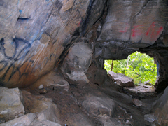
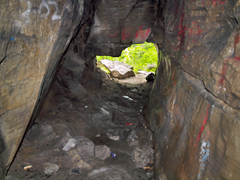
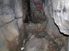
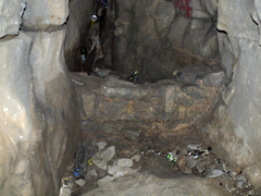
The entrance to Devil's Hole Cave is 10 feet wide and 8 feet high. The floor of the easterly trending passage slants gently upwards, and after 12 feet the passage is only 4 feet high. Just past this point, the ceiling quickly reaches a height of 9 feet. The passage then gradually tapers in width and at 30 feet from the entrance there is a low man made wall that extends across the passage. Past the wall there is a 2.5 foot drop in the floor level. Past this point the passage tapers to 6 inches wide and 6 feet high in the remaining 10 feet of the cave. The passage can be seen to continue to the east.
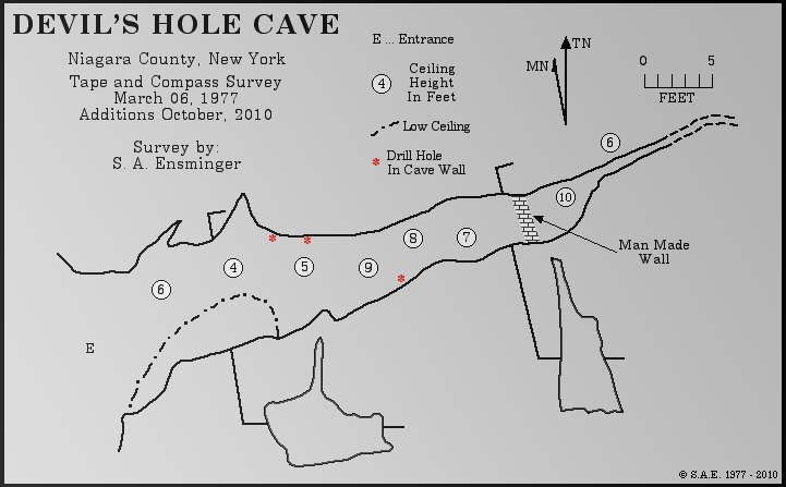
Devil's Hole Cave is developed in DeCew Dolostone, a very fine crystalline dolostone that is dark gray in color. The rock dates from the Silurian Period and is around 420,000,000 years old. It is a solutional cave being formed by naturally acidic groundwater that seeps through bedding-planes, cracks and joints in the rock. Over thousands of years the rock is dissolved and the cracks enlarge. The dissolved rock is carried away by the flowing water. Stream scallops found along the northern wall, near the back of the cave and the Mineral Spring mentioned in the Great Gorge Route Railroad brochure confirm that Devil's Hole Cave is a solutional cave. Devil's Hole Cave probably began to develop around 10,400 years ago, after Niagara Falls had eroded past the area that is now the Lost Channel. The Lost Channel is a re-entrant gorge eroded by an outlet from ancient Lake Tonawanda.
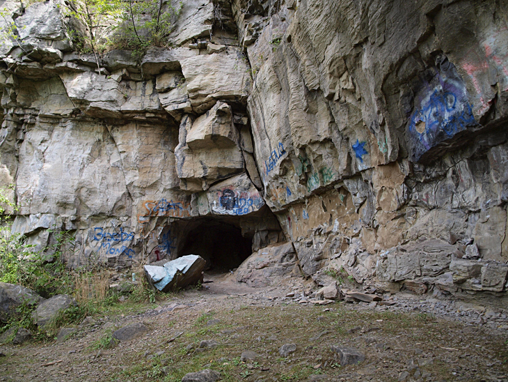
The entrance area to Devil's Hole Cave --- September, 2010
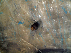
The first two photos in the second row show the man made wall that extends across the passage. The last photo shows a drill hole in the southern wall of the cave. The drill hole is a little over 1 inch in diameter and 3 inches deep.
For a ACME Mapper 2.0 map of the area click here. Web site: Devil's Hole State Park Copyright © 2010 by Scott A. Ensminger. This information may not be reproduced without written permission.  You can send me e-mail at: falzguy@verizon.net
Return to Other Stuff By SAE Return to Home Page of WNYWS |


