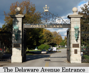
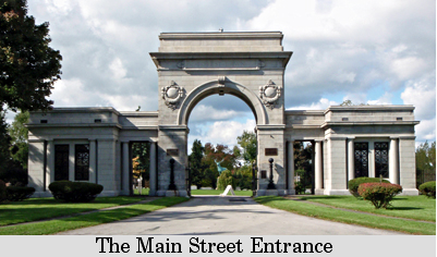
Forest Lawn Cemetery is located in in the center of Buffalo to the west of the intersection of Main Street (Route 5) and Scajaquada Expressway (Route 198). The cemetery has two major entrances. One is located at the corner of Delaware and West Delavan Avenue. The other is located at the corner of West Delavan Avenue and Main Street (Route 5). A third entrance is located across from the intersection of Main Street (Route 5) and Jefferson Avenue. Click on the map above (or here) for a larger map of Forest Lawn Cemetery.
Forest Lawn is first and foremost an active cemetery. The hallowed grounds deserve your utmost respect. Funeral processions and privacy of mourners must take priority over your visit to the falls.
During the summer months (April through October), the grounds are open as follows: 8:00 a.m. to 7:00 p.m. via the Delaware Avenue gate; 8:00 a.m. to 5:00 p.m. via both the Main Street and Jefferson Avenue gates. From early November through March, the gates close earlier. Please call the Forest Lawn Cemetery office at (716) 885-1600 for details. Email: flc@forest-lawn.com.
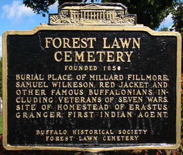
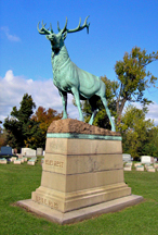
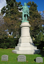
Forest Lawn is much more than just a 269 acre cemetery with over 156,000 permanent residents. The grave sites of many famous and interesting individuals are located in the cemetery. There are numerous large striking monuments, impressive sculptures, and majestic mausoleums. With more than 10,000 trees it is also an arboretum. The many varieties of trees found in the cemetery make it a stopping spot for migrating birds. Over 240 species of birds have been spotted on the grounds.
To learn more about this inspiring cemetery you can purchase exclusive publications directly from Forest Lawn Publications.
Serenity Falls is located on Scajaquada Creek closer to the Main Street entrance gate. After passing beneath the entrance arch turn right (north). The road will quickly fork to the left and right. Follow the road to the right (northwest) crossing over Scajaquada Creek. After crossing the creek turn left (northwest) on the first road, passing the Costentino Mausoleum. Section 20 of the cemetery will be to your left (south). After passing a road to your right (north) find a spot to pull over and park. Do not park or drive on the grass. Look for the 6 foot high Pottinger grave marker and the Kelly grave marker to the right of it. Walk to the south passing between these two grave markers until you come to the small, 12 feet deep valley of Scajaquada Creek.
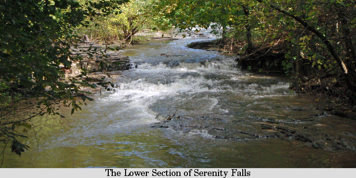
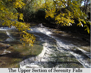
Serenity Falls is more of a series of small cascades and rapids than a true waterfall. It is comprised of two sections. The lower section consists of two small drops and a gradual cascade with a total height of 4 feet. The flood width of the creek bed is 54 feet but the creek is usually contained in a channel that is 21 feet wide. This section faces to the west. You may want to take along a trash bag to carry out some of the plastic litter found along the creek. You'll be helping to make Forest Lawn even more beautiful than it already is.
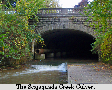
The upper section of Serenity Falls is a little more interesting. To view it walk upstream along the northern creek bank. It consists of five major drops and a small rapids. This section of the falls has a total height of 8 feet. The crest is 39 feet wide and faces to the west northwest. To sum it up, Serenity Falls has a total vertical drop of 12 feet in a horizontal distance of 200 feet. It is one of two waterfalls found in the City of Buffalo, the other waterfall being Cazenovia Park Falls. It drops 6 vertical feet in a horizontal distance of 150 feet.
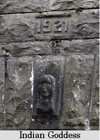
You may be wondering how Scajaquada Creek got its name. The following information is from The Life of General Ely S. Parker by Arthur C. Parker, 1919. The Seneca Nation of Indians would often conquer and absorb other tribes. The Neutrals or Kah-kwah was one such tribe. Around the time of the American Revolution a group of Senecas settled on Tonawanda Island in the Niagara River. Among this group was a Kah-kwah family who ancestors had been living with their Seneca conquerors. One of the family members was called Sag-dyne-gwa-dih or Sken-dough-gwat-ti by the Senecas. The name meaning Beyond the Multitude. He later moved with his family to the bank of Scajaquada Creek to the east of Niagara Street. His name was anglicized to John Kenjockety and early Buffalo settlers called the stream Kenjockety's Creek.
John Kenjockety was a famous hunter and his loyalty to his adopted Seneca people was intense. He was called the second man of influence and character among the Seneca of Buffalo. In 1789 Kenjockety protested to New York Governor George Clinton against the sale of Seneca lands. Later Kenjockety was a joint agent with Red Jacket for the Senecas in determining the boundaries of the Seneca dominion. John Kenjockety died in early October of 1808.
The modern spelling of Scajaquada appears to be a modification of John Kenjockety Seneca name Sag-dyne-gwa-dih. In his book Mr. Parker lists 76 variations of the spelling of Scajaquada. All being designations of the same creek.
The Battle of Black Rock, in the War of 1812, was fought on the banks of Scajaquada Creek near the junction with the Niagara River. It is stated that some of the vessels in Commodore Oliver Hazard Perry's fleet, which won the Battle of Lake Erie in September of 1813, were fitted out with barrels of water from Scajaquada Creek.
Serenity Falls is developed in Akron Dolostone. The rock ranges in color from a light tan to greenish gray. It dates from the Late Silurian Epoch giving the rock an age of 423,000,000 to 419,000,000 years. Akron Dolostone has been used in the manufacture of cement and as a building stone. The falls is located on the lower portion of the Onondaga Escarpment, named for the gray, chirty Onondaga Limestone found at the escarpment's crest.
Lower Section of of Serenity Falls Upper Section of of Serenity Falls
Upper Section of of Serenity Falls Upper Section of of Serenity Falls


 You can send me e-mail at: